
Best Car GPS for Off-Road (2026): We Compared
The best car GPS for off road is the one that fits your terrain: choose a rugged Garmin or similar dedicated unit for frequent trail travel, and a phone app with offline maps for lighter trips or budget setups. Pick poorly, and you can lose signal, miss turnoffs, drain batteries, or mount a screen that fails when dust, vibration, and weather hit. This guide compares dedicated GPS units and offline apps by map support, durability, battery life, and mounting fit for SUVs, trucks, and overland travel.
Quick comparison
This comparison focuses on map depth, ruggedness, and total ownership cost, because those factors usually matter more than brand name alone. The right answer changes with terrain, trip length, and whether you need a dashboard device or an app-first setup.
How we chose
We compared each option on offline map quality, ruggedness, screen readability, mounting and power needs, and the cost of maps or subscriptions over time. The goal was not to pick the most expensive unit, but to separate mixed-use touring, trail groups, land-access planning, and route building.
We also weighed failure cases that get skipped in many roundups: outdated trail data, weak GNSS lock in canyons, glove-unfriendly screens, and mounts that shake loose on washboard roads. That matters because a unit that looks good on paper can still be hard to trust in the field.
Say your weekend trip is a 40-mile forest-road loop with occasional service gaps. A phone app with offline downloads may be enough. Now suppose the route runs through slot canyons and requires a dash mount that survives hours of vibration; a dedicated rugged unit becomes the safer buy.
Decision matrix
| Option | Offline maps | Ruggedness | Screen readability | Mounting complexity | Subscription cost | Best terrain type |
|---|---|---|---|---|---|---|
| Garmin Overlander | High; preloaded topo and street maps | High; rugged handheld build | High; 7-inch class display | Medium; vehicle mount and power needed | Low to medium; maps included, extras vary | Mixed terrain, long overland routes |
| Garmin Tread | High; off-road focus and route tracking | High; ruggedized display and housing | High; larger, trail-friendly screen | Medium to high; vehicle and powersport setups | Low to medium; depends on map and add-ons | Trail groups, powersports, rocky routes |
| onX Offroad | High with download; app-based offline regions | Depends on phone or tablet used | Depends on device; usually strong on modern phones | Low; phone mount and power bank or 12V | Medium; subscription required | Land access, scouting, day trail planning |
| Gaia GPS | High with saved regions and layered maps | Depends on device; app-first stack | Depends on screen size and brightness | Low; phone or tablet mount | Medium; subscription for full features | Route planning, topo-heavy trip prep |
| Garmin Montana 700i | High; TopoActive plus city navigation | High; military-grade rugged body | High; 5-inch glove-friendly touchscreen | Medium; vehicle mount and external power | Low to medium; renewed unit reduces entry cost | Trail travel, remote travel, backup navigation |
| Phone plus offline maps | High if regions are downloaded | Low to medium; depends on case and phone | High on bright phones, lower in direct glare | Low; simple cradle and charging | Medium; app plans add up | Budget use, light overlanding, scouting |
Car gps table
| Option | Device price | Map fees | Mount and accessory costs | Typical total entry cost |
|---|---|---|---|---|
| Garmin Montana 700i | $499.99 | Included maps; optional extras vary | Vehicle mount, power cable, and possibly RAM-style hardware | About $550 to $650+ |
| Garmin Overlander | Varies by market | Included topo and street maps; optional map add-ons may apply | Vehicle mount, power lead, possible external antenna | Often $650 to $900+ |
| Garmin Tread | Varies by variant | Included off-road maps; extra services may cost more | Vehicle or powersport mount, power cable, optional antenna | Often $700 to $1,100+ |
| onX Offroad | Phone or tablet already owned | Subscription required | Mount, charger, maybe rugged case | About $80 to $300 first year, plus device |
| Gaia GPS | Phone or tablet already owned | Subscription required for full offline planning | Mount, charger, maybe tablet holder | About $60 to $250 first year, plus device |
| Phone plus offline maps | Already owned or new phone purchase | App subscription or one-time map fees | Cradle, charging cable, optional rugged case | About $30 to $200 if using an existing phone |
Garmin Montana 700i: best for mixed terrain

The Montana 700i is a strong fit for buyers who want a rugged GPS with a glove-friendly 5-inch touchscreen, preloaded TopoActive maps, and city navigation in one unit. Based on the published product details, it fits mixed use better than app-only setups when the trip blends pavement, fire roads, and remote track.
Its biggest strength is that it stays useful when cell service drops and the route changes from highway to trail. That makes it a strong answer for overlanders who want a single device that can handle roads and trails without depending on a phone battery or a data signal.
The drawback is cost and complexity. A dedicated handheld still needs a mount, power, and sometimes extra accessories, and a renewed unit can reduce upfront cost without removing the need to plan the install carefully.
Garmin’s preloaded map ecosystem matters here. Offline topographic maps give contour lines, trail networks, and waypoint support, while GNSS support helps position lock in remote terrain where a phone may hesitate under tree cover or canyon walls.
Mounting also matters. A dash or windshield setup with 12V power keeps the screen ready for long drives, but vibration resistance and quick release should stay on the checklist if the route includes washboard roads.
Garmin Tread: best for trail groups
Garmin Tread fits drivers who want an off-road-focused navigator with group ride and trail tracking, especially in trail convoy use or powersport applications. It makes the most sense when a ruggedized display and trail-oriented tools matter more than general street routing.
Its strength is specialization. Vehicle and powersport variants let buyers match the unit to the mount style and cockpit space, which helps if the device must handle dust, bumps, and gloves at the same time.
The drawback is that Tread can be more device than a casual forest-road driver needs. If the route is mostly easy access roads with a few short trail spurs, the price and setup effort may exceed the actual benefit.
For group trips, trail tracking and shared route context can matter more than raw screen size. For solo overland travel, the value depends on whether you need that off-road focus or just a stable offline map display.
onX Offroad: best for land-layer planning
onX Offroad is best for buyers who care about land ownership layers, offline trail downloads, and trip planning on a phone-based stack. It shines when you need to know public and private boundaries before you ever leave pavement.
Its main advantage is map ecosystem depth. The subscription model gives access to layers that dedicated GPS units often do not present as clearly, and downloadable regions can keep route context available without cell service.
The drawback is dependence on the phone or tablet you already own. That means ruggedness, battery life, and glare control become your responsibility, not the app’s, and a weak mounting setup can ruin the experience quickly.
For hunting access, scouting, and weekend trail use, this can be the most practical answer. For long remote trips or wet, dusty, high-vibration cabins, a dedicated unit still has an edge.
Gaia GPS: best for route planning
Gaia GPS is best for drivers who want topographic layers, route creation, and multi-layer planning before the trip starts. It is a strong planning tool for overlanders who build routes from maps first, then use the same app offline in the truck.
Its main strength is flexible map stacking. That helps when you want contour lines, forest service data, and saved regions in one place rather than bouncing between separate apps or paper maps.
The drawback is that it still depends on the device you mount in the vehicle. If the phone screen is small, hot, or washed out in direct sun, the app cannot fix that for you.
Gaia tends to fit trip prep better than trail-only navigation. For rough terrain, it works best when paired with a secure mount, external power, and a phone or tablet with good brightness.
Off-road GPS comparison matrix
Use the scores below as a decision aid, not a lab result. A higher score means better fit for that category, based on published features, map support, and the cost and mounting burden a buyer should expect.
Scores by category
| Option | Offline map depth | Ruggedness | Readability | Mounting and ownership cost | Overall fit |
|---|---|---|---|---|---|
| Garmin Montana 700i | 9/10 | 9/10 | 8/10 | 7/10 | Very strong for mixed terrain |
| Garmin Tread | 9/10 | 9/10 | 9/10 | 6/10 | Best for trail groups and powersports |
| onX Offroad | 8/10 | 5/10 | 8/10 | 8/10 | Best app-first land-access tool |
| Gaia GPS | 8/10 | 5/10 | 8/10 | 8/10 | Best for route planning and topo layers |
| Phone plus offline maps | 7/10 | 4/10 | 7/10 | 9/10 | Best budget option if you already own a strong phone |
What matters most in the field
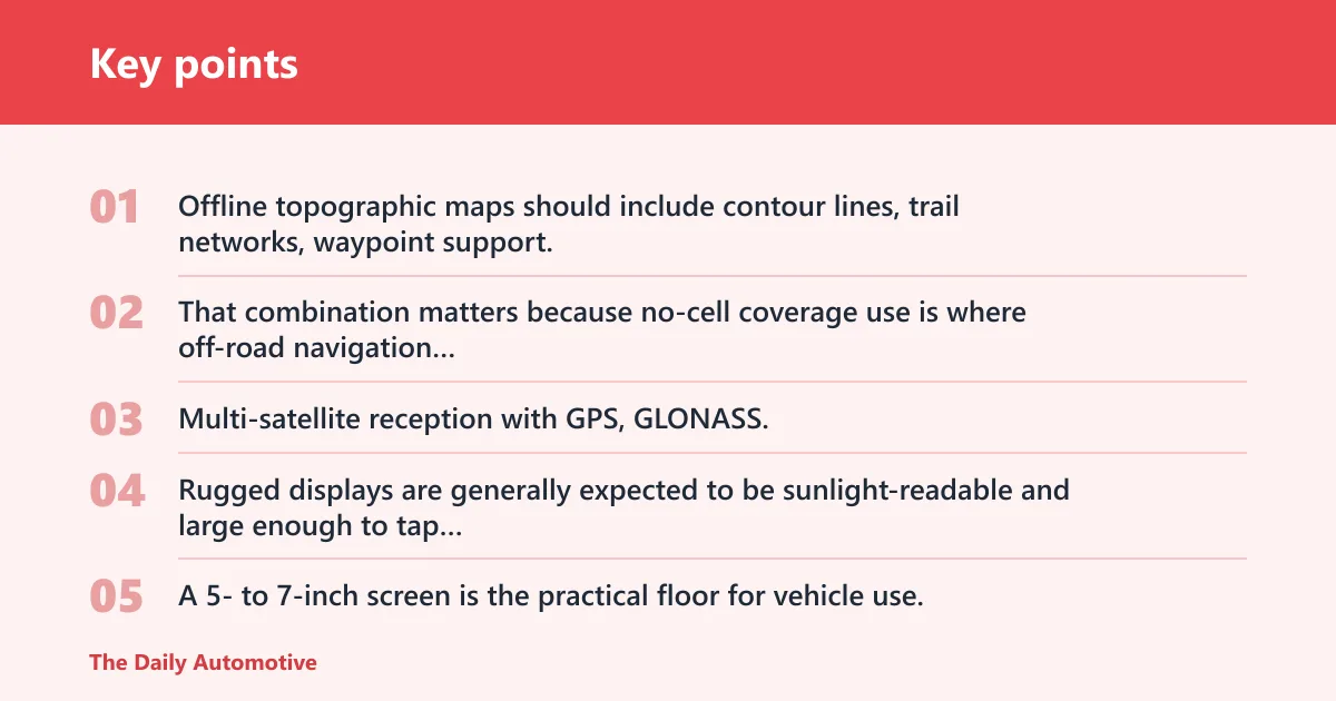
Offline topographic maps should include contour lines, trail networks, waypoint support, and downloadable regions. That combination matters because no-cell coverage use is where off-road navigation usually fails, not on a clean highway with full signal.
GNSS support also matters. Multi-satellite reception with GPS, GLONASS, and Galileo can help maintain position lock in remote terrain, though it does not replace a good map layer or a solid mount.
Rugged displays are generally expected to be sunlight-readable and large enough to tap with gloves. A 5- to 7-inch screen is the practical floor for vehicle use, while dust and water resistance should be backed by an IP rating such as IPX7 or similar.
Mounting should not be an afterthought. Dash, windshield, or roll-cage mounting needs 12V power and enough vibration resistance that the unit stays readable when the road turns rough.
Which one should you buy?
Buy the Garmin Montana 700i if you want one rugged device that can handle mixed terrain, offline navigation, and a glove-friendly screen without making you rely on a phone. Buy Garmin Tread if your driving is mostly trail group, powersport, or rough-use focused and you want the most off-road-specific platform.
Choose onX Offroad if land ownership layers and trail access planning matter more than hardware ruggedness. Choose Gaia GPS if route creation and multi-layer topo planning are the priority, especially for trip prep on a phone or tablet.
If your budget is tight, start with an app-first setup and spend on a good mount, charging, and a bright phone. If your trips are longer, dustier, or more remote, the dedicated route usually pays off in lower risk and less screen trouble.
Picture a driver heading into a canyon network with no service for the rest of the day. A phone app can still work if the region is downloaded and the device stays powered, but a rugged dedicated GPS reduces the chance of losing the route to heat, glare, or vibration.
A common first-timer mistake is buying a normal car GPS and assuming it will handle a dirt-road trip. Many street-first units lack the topo detail, trail layers, and land data that make off-road routing reliable.
Frequently asked questions
What is the best car GPS for off road use?
The best car GPS for off road use is the one that matches your terrain and how often you drive out of cell range. For frequent trail travel, a rugged dedicated unit such as the Garmin Montana 700i or Garmin Tread is the safer choice. For lighter trips, a phone app with offline maps can be enough.
Do off road GPS units work without cell service?
Yes. A true off-road GPS should work without cell service because it relies on downloaded map data and satellite positioning, not mobile data. The catch is that map coverage still matters. If the topo layer, trail file, or land boundary data is outdated or incomplete, offline navigation can still fail at the turnoff.
What maps should an off road navigator have?
An off-road navigator should have topographic maps with contour lines, trail networks, waypoint support, and downloadable regions for no-signal use. Land ownership layers are also valuable for hunting, scouting, and access planning. For longer routes, street maps can help with pavement transitions and fuel stops.
Is Garmin or a phone better for off road navigation?
Garmin is usually better for repeated rough use because the hardware is built for vibration, dust, and glove use, while a phone is usually better for cost and flexibility. The phone wins on app choice and price. The Garmin wins when the route is remote, the mount is rough, or the screen must stay visible all day.
Can I use a normal car GPS off road?
You can use a normal car GPS on easy dirt roads, but it is a poor match for real off-road travel. Many street units lack detailed trail layers, topographic context, and land access data. They may also struggle with mounting stability, glove interaction, and route changes once pavement ends.
How much does an off road GPS cost?
Cost ranges widely. A phone-based setup may start with hardware you already own plus a subscription and a mount. Dedicated units cost more up front, and total cost should include map fees, mounts, power cables, and possible antenna accessories. The Garmin Montana 700i shown here is listed at $499.99, before mounting and power.
Products related to this article
Sponsored / affiliate links. As an Amazon Associate I earn from qualifying purchases. I may earn additional commission from eligible campaigns.